2025-10-23 Mouth of the Murray
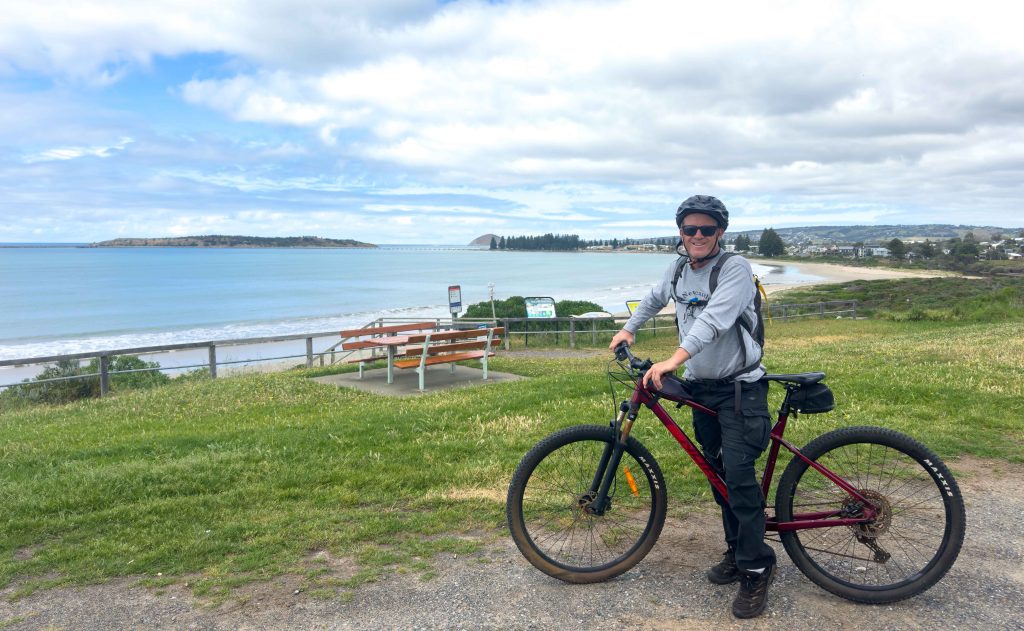
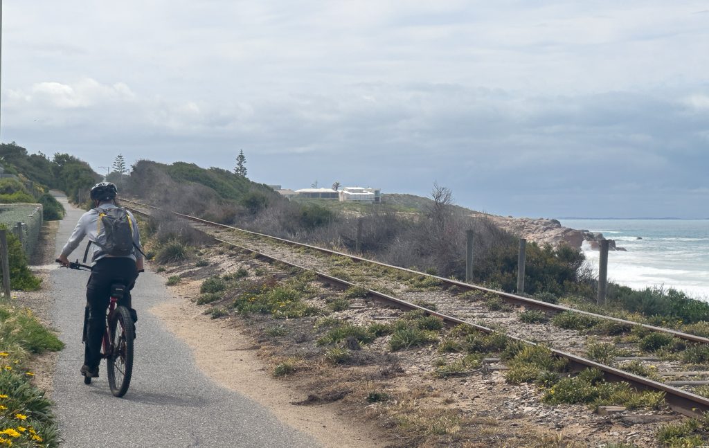
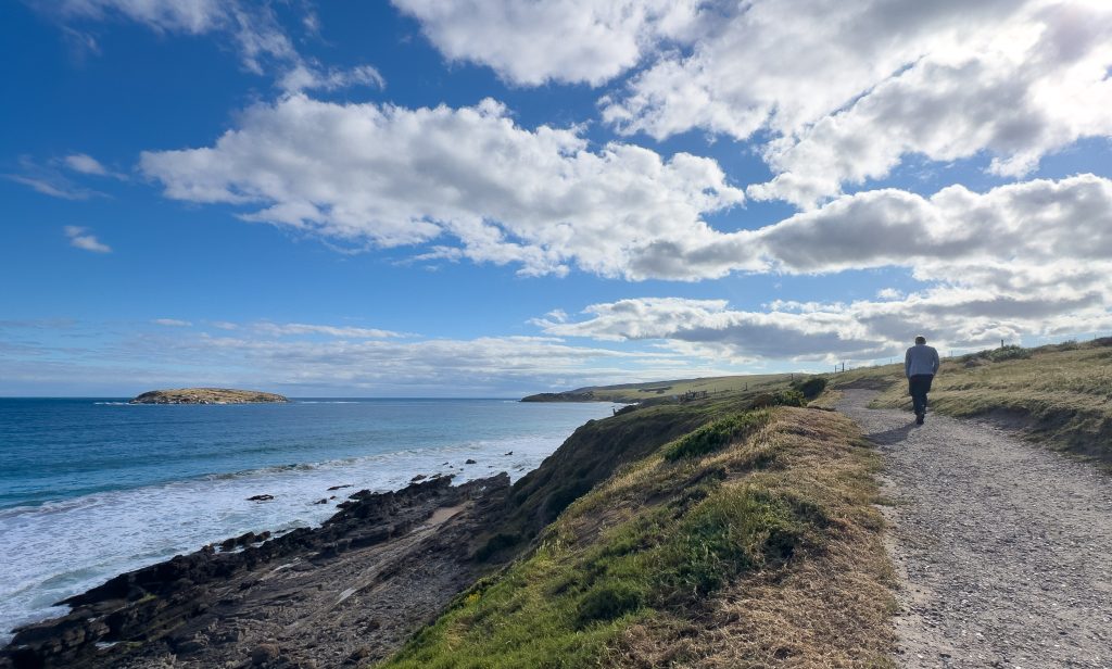
We finally woke today to calm conditions. First time in the best part of a week I reckon, so Bob and I decided to get the bikes off the van and hit the Victor Harbor coastal cycle trail. We stopped in first at the Tourist Info centre to get a map of the trail and get any insights into the things we should include in our next 24 hours in the town.
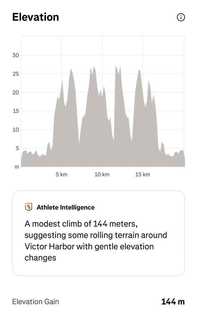
Advice from Mr Tourist Info was that the cycle trail was 99% flat with a couple of small rises….. well 144m of climbing later I beg to differ! Much less than the biggest hills we’ve hit this trip but I wasn’t mentally prepared. Regardless, we enjoyed the 20km ride and found the bakery at Port Elliot for Bob to have a coffee and to share a very nice vanilla slice!
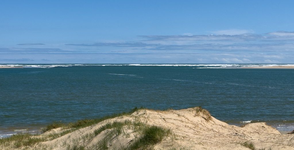
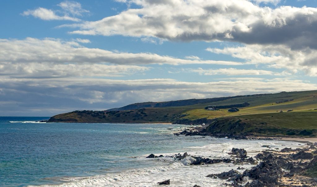
We came back to the van for lunch and then headed back out in the car to explore further afield. Our first stop was the mouth of the Murray River on Hindmarsh Island. Not particularly visually impressive but certainly quite interesting. In order to keep the mouth of the river open and the ecosystems it supports healthy, the mouth began being dredged back in 2002. Due to ongoing drought conditions the dredging has continued since then and will only stop once there is sufficient flow to keep it open. Interesting facts include that up to 1 million cubic metres of sand are pumped away each year (and then redistributed to replenish beach sand naturally using tidal movement), and that the mouth of the Murray has moved within a range of 6-8km along the channel during the last 3000 years.
We then headed back to the historical town of Goolwa. This is the last port town on the Murray before the mouth of the river. We spent some time exploring the historical jetty precinct before moving on to the Goolwa Barrage.
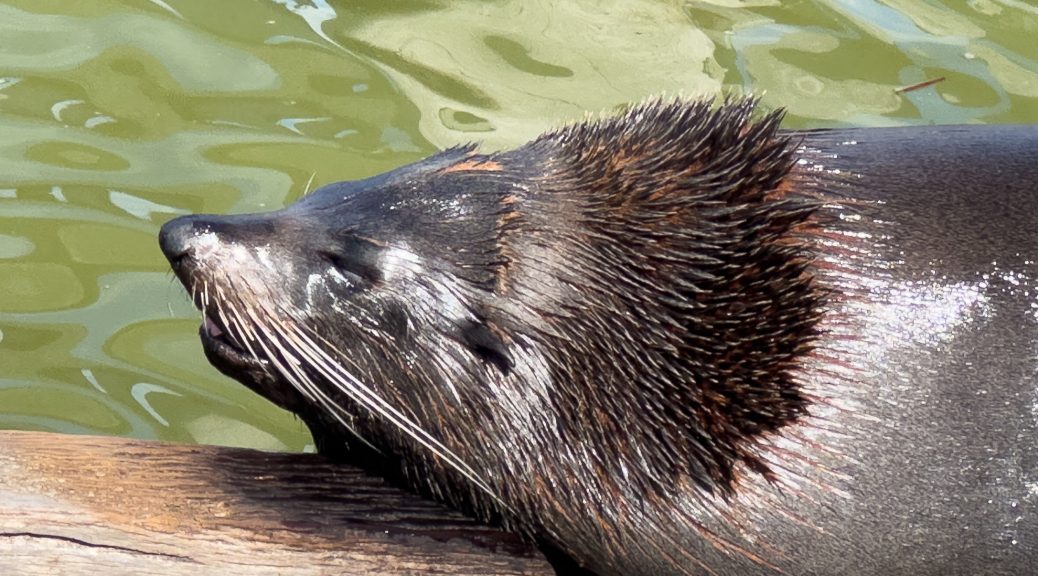
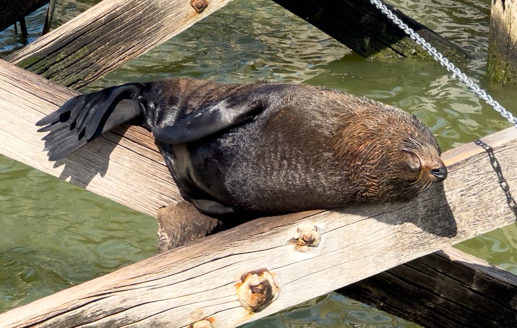
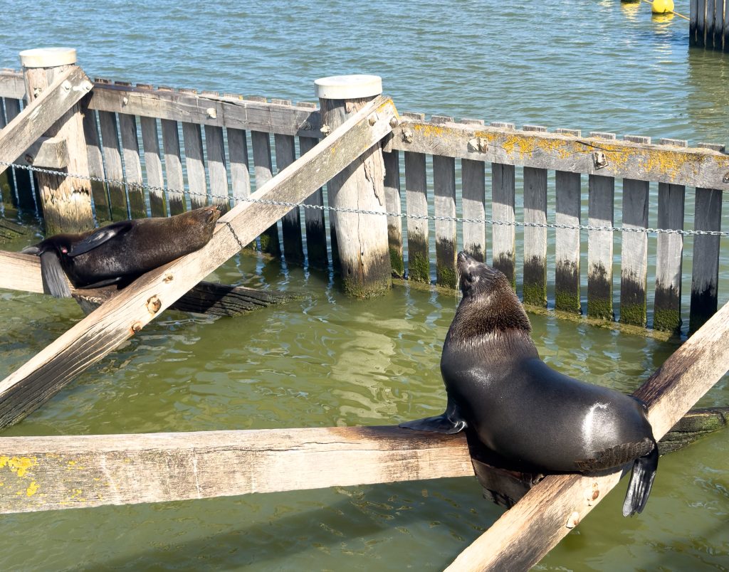
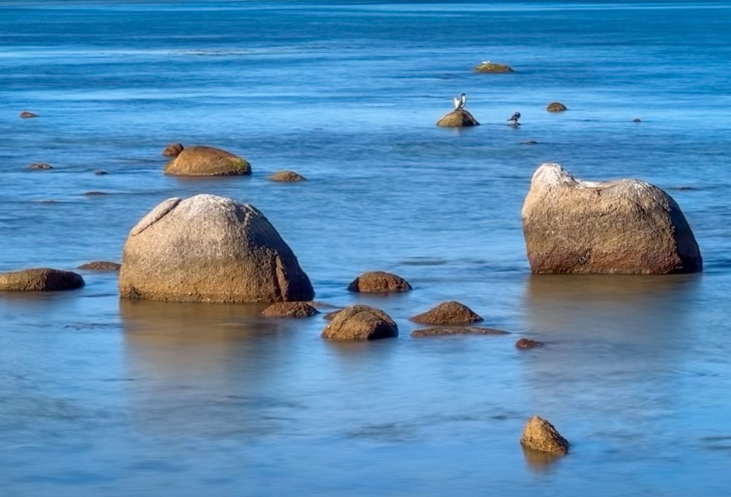
This was my favourite part of the day. We arrived with no expectations and found a very detailed signboard description of the weirs, locks and barrages that have been installed along the length of the Murray in the last 100 years. The Goolwa Barrage is the barrier between the salt water at the mouth of the river and the fresh water upstream. It effectively dams the river and holds fresh water behind it to allow irrigation for crops. The water flow through the barrage was laden with fish and there was a healthy population of pelicans and other birds as well as New Zealand Fur Seals (I hope that is right Louise cause that was what we read, but they had ears???) enjoying the spoils.
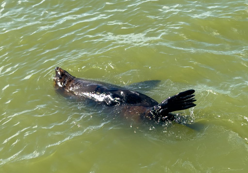
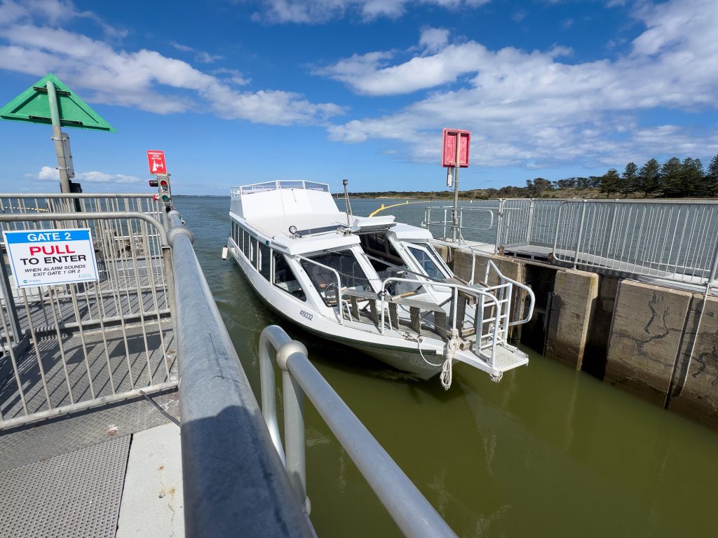
While enjoying the nature spectacle we were suddenly locked onto the middle of the barrage and were treated to the local tour boat going through the lock to get back to the township. There is only a 70cm difference between the two water levels but the volume of water pumped to effect the transition in literally a couple of minutes was seriously impressive!
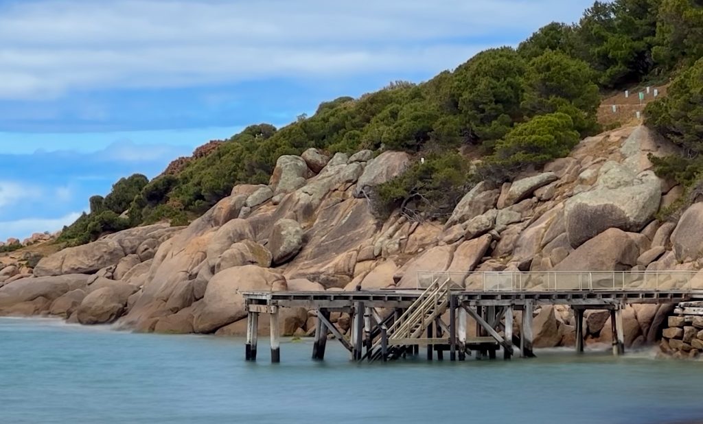
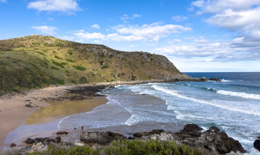
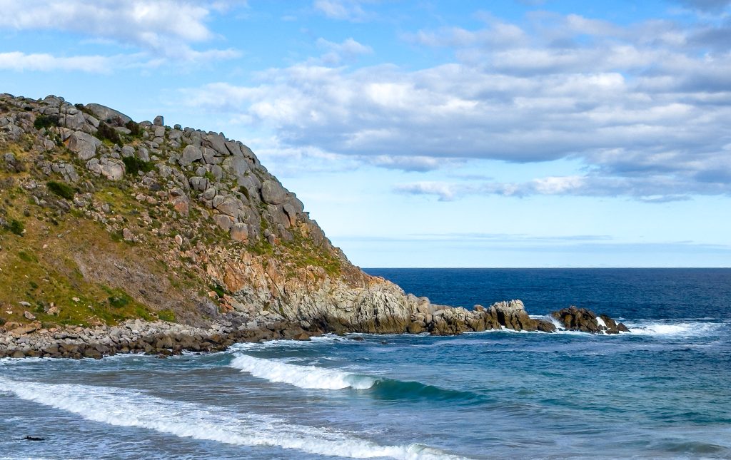
To round out the day we headed back past Victor Harbor to The Bluff. Impressive views in both directions up and down the coast. We walked a portion of the Heyson Trail and saw some really lovely coastline.
Tomorrow we continue our drip feed back in the general direction of home. Will head further south along the coast and see where we end up.
2 thoughts on “2025-10-23 Mouth of the Murray”
Hi Kerri, the ear thing on seals and sea lions does not look so straight forward for identification unless you have one of each species nearby to compare. Looking at photos, I think you have been viewing seals. Sea lions have rounder faces with puppy dog like noses whereas sea lions have more pointed faces. Female sea lions are silver with cream bellies so quite different to the brown furred males. Also sealions tend to beach on the sand on more remote places like islands and walk with their front flippers turned backwards. So I’m guessing your photos are of seals. Enjoy your exploring
Hi Louise thanks heaps for your detailed response.